
Tracing a Chaska Street by Address
A Chaska address-record search begins with the physical Chaska parcel, not an assumed list of residents. A current Chaska property record can identify the owner recorded for assessment and give the PID. The Chaska parcel map can then show adjacent lots. A Chaska deed can establish a recorded transfer, while historic Chaska phonebooks or Chaska papers may add a dated subscriber or event. Keep each Chaska role distinct: owner, tax-mailing addressee, grantor, grantee, permit applicant, and listed subscriber are not interchangeable.
Write the Chaska address in its USPS-standardized form, including house number, directional, suffix, unit, and ZIP. Start with the current Chaska situs address, then preserve the PID and legal description before moving backward. This avoids confusing an old Chaska block reference or a similar owner name with the selected Chaska parcel.
- Search the Chaska address in Carver County Property Information and capture the Chaska situs address, PID, current record owner, and visible Chaska tax or plat links.
- Open the Chaska parcel map and select nearby Chaska parcels one at a time; street numbering does not always follow lot boundaries.
- Use the owner as a Chaska LandShark grantee lead, then compare the legal description and recording details before treating a Chaska deed as the same parcel.
- Search the confirmed Chaska seller as a prior grantee when tracing an earlier transfer, again matching the Chaska parcel and legal description.
- For historic household context, consult verified Chaska phonebooks, Herald pages, Sanborn maps, and local collections.
Note: MNVotes is a voter self-check form, not a street-browse tool, and its restricted walking list may not be republished online.
Chaska Street Directory Property Search
Carver County Property Information is the first current-record step for a Chaska address. Its Chaska workflow connects a selected Chaska property to the Property Report Card, an available plat, LandShark, and a tax summary. The dynamic app supports Chaska address and Chaska owner-property searching, although the county’s static landing page does not expose every field label or result-card layout.
| Visible property feature | Street-directory use | Format or caution |
|---|---|---|
| Property Report Card | Read the selected Chaska parcel’s property summary. | Chaska live result fields can vary. |
| Available Plat | Move from a Chaska parcel to the recorded subdivision image. | Available only where a plat is linked. |
| Land Records | Open the separate Chaska LandShark document search. | Search party and document details there. |
| Tax Summary | Review current Chaska tax-record detail. | Tax descriptions may be partial. |
| Map browse | Select a Chaska parcel and pan to surrounding Chaska parcels. | Current static materials do not list all layers. |
For a whole Chaska street, pan through the interactive map and click Chaska parcels instead of expecting an address query to return every property. The current inspection of the Chaska app did not verify a whole-street select, buffer, or export control, so those features should not be assumed.
Chaska Street Address Terms
Chaska address records become more accurate once the terms are separated. The current Chaska property workflow can show several kinds of location data, and a Chaska deed may use a legal description instead of a familiar street number. Save the Chaska source’s own wording before normalizing it for search. That is especially important where older Chaska downtown blocks, annexed Chaska parcels, or abbreviated tax descriptions are involved.
- Parcel or PID
- The mapped tract of land and its county identifier. It ties the property report, plat, tax records, and deed work together.
- Situs address
- The physical location of the parcel or building. This is the address to begin a street search.
- Mailing address
- The address used for assessment or tax notices. It can be outside Chaska and does not establish occupancy.
- Plat
- A recorded map of a subdivision that can connect a lot and block to a PID or street address.
- Criss-cross directory
- An address-organized directory. A Chaska title and year run are not verified, so ask whether a phonebook has a street section.
Note: A homestead indicator can be evidence of a claimed primary residence for taxes, but it is not proof of daily presence or every household member.
Chaska Street Directory Plat Search
Carver County Plat Search is the practical bridge between a Chaska street address and the lot, block, addition, or plat behind it. The public form offers a PID field, property site address, first-letter browsing, a keyword field, and Include Only controls. Its PID instruction is precise: enter the number without periods or hyphens. The tool is a Chaska map and plat aid, not a replacement for a recorded deed.
The county Plat Search interface shows the address and PID routes available for Chaska parcel research.
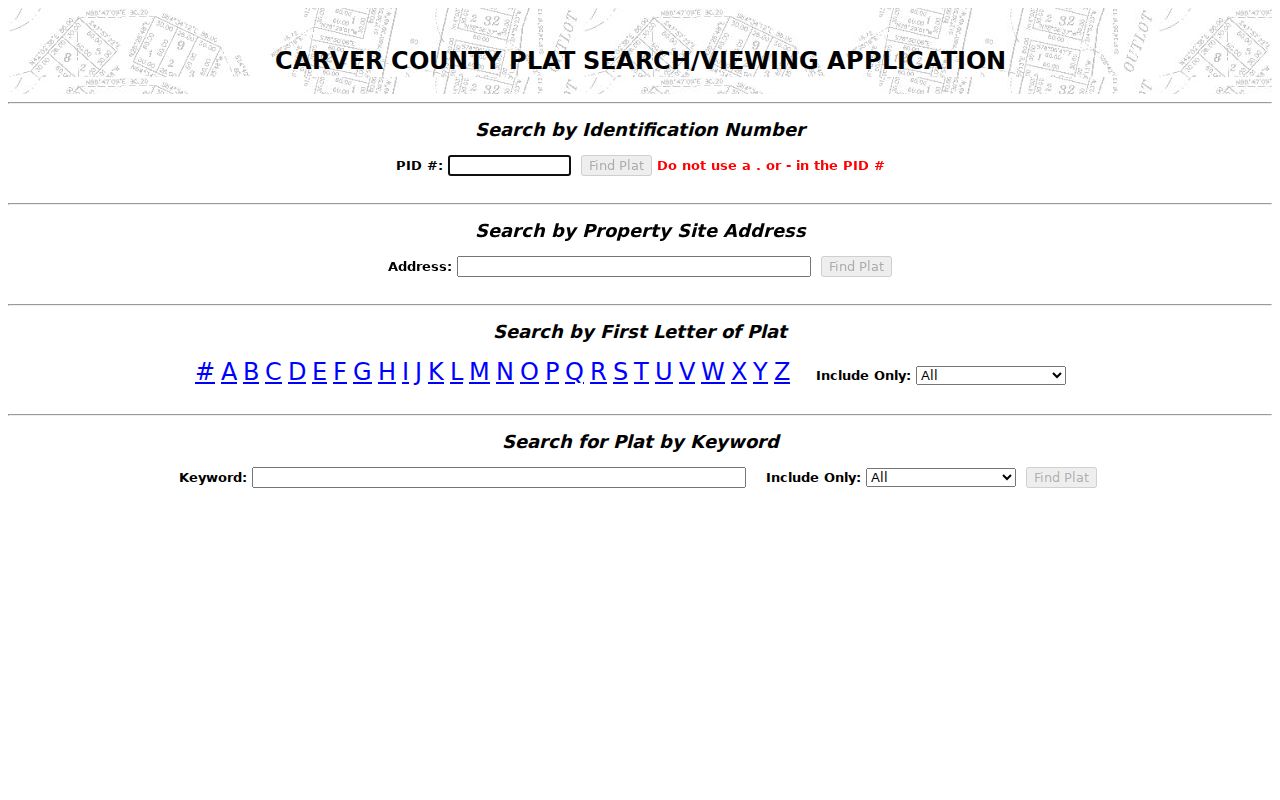
Use the plat result to compare the subdivision and lot-block language against the property report or deed. It is particularly useful when an old description has not yet been translated to the present situs address.
Chaska Street Directory Deed Trail
The recorder’s LandShark system provides online Chaska document indexing from 1988. Its visible search choices include business or last name, first name, middle initial, document type, instrument group, date range, and the option to search both grantors and grantees or only one role. Grantor means the party transferring an interest. Grantee means the party receiving it.
Start with the confirmed current owner as grantee or in both-party mode. Record the document number, recording date, legal description, seller, and available image information. Then search the seller as an earlier grantee and compare the legal description or PID each time. The portal’s date-range validation changes by search mode, and its dynamic document-type options should be chosen in the live interface.
The LandShark deed index exposes the party and document controls used for an address-based trail.
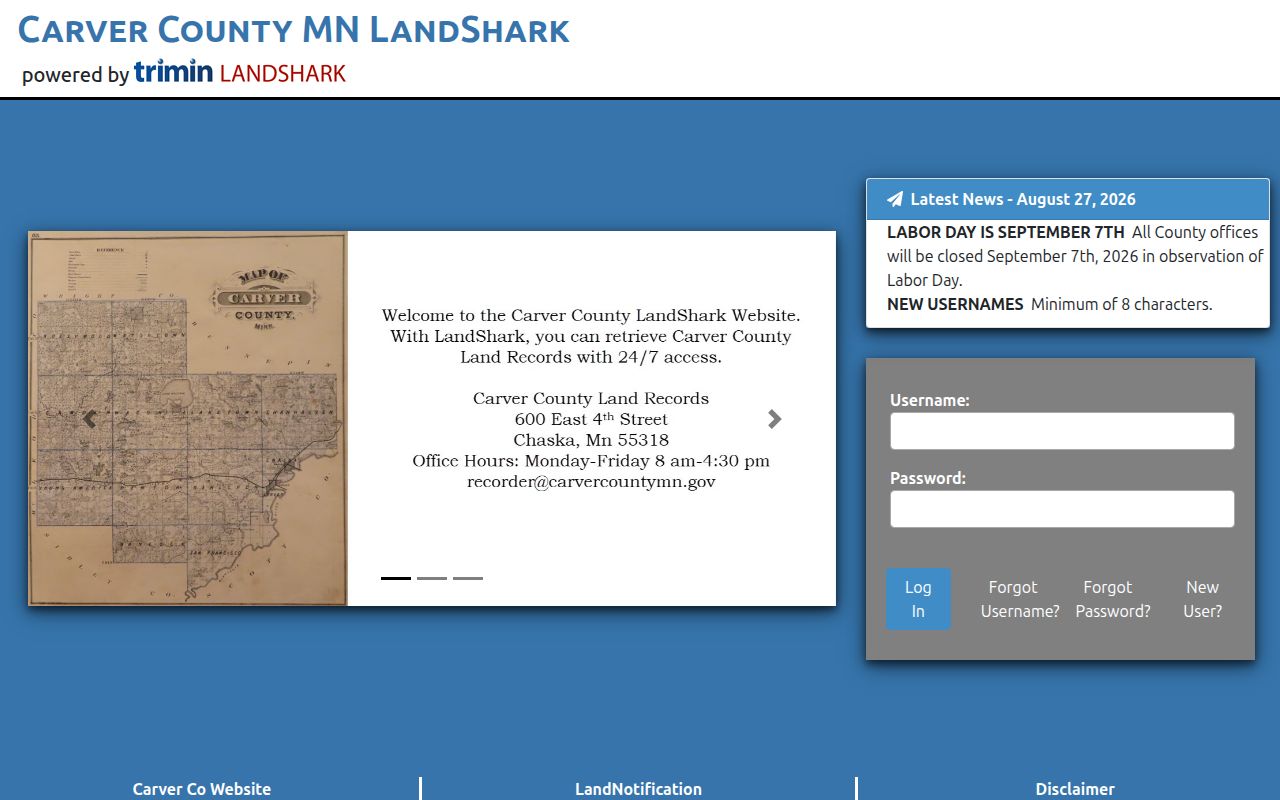
The image search controls are a lead to recorded instruments. A matching surname alone is not enough; parcel or legal-description comparison prevents a transfer from another property being attached to the street.
Chaska Street Directory Record Sets
Address-keyed records describe different layers of a Chaska street. Property Information supplies the current parcel frame. Plat Search translates it into subdivision and lot-block terms. LandShark documents recorded transfers. Permits show construction or application activity. Historical maps and phonebooks add dated context. The voter walking-list route is limited by state law and is not a source to publish as a neighborhood roster.
| Address record | Keeper | What it can show | Access |
|---|---|---|---|
| Assessor/property report | Carver County Property Information | Owner, situs, mailing address, PID, values, characteristics | Free dynamic app; historical years not stated |
| GIS parcel map | Carver County GIS | Parcel boundaries and links to property resources | Free map; select parcels individually |
| Plat and lot-block record | County Plat Search and Surveyor | PID, address, subdivision, lot/block, plat image | Free PID, address, and keyword routes |
| Recorded deed | Land Records & Vitals | Grantor, grantee, date, instrument, legal description | LandShark from 1988; older counter |
| Building permit | Chaska Building Inspections | Work, applicant, contractor, PID/address, date | Current online subset; historical request |
| Historic phonebook or map | History Center and Historical Society | Listed subscriber, street context, building footprint | Onsite or local digitized access |
An address-record result should identify which of these roles it reflects. A record owner may receive tax mail elsewhere. A permit applicant may be an owner or contractor. A listed phone subscriber may be absent from a later edition.
For a Chaska address that changes form across records, make a small comparison list: the current Chaska situs, PID, legal description, date, source, and role named by each record. That list can show whether an older Chaska phonebook, Sanborn block, permit, or recorded document belongs to the same place. It also makes a negative result useful. If the PID or legal description differs, stop the chain rather than carrying a nearby street number into the next Chaska search.
Chaska Street Permit Records
Chaska Building Inspections describes an address-focused SmartGov permit route for siding, roofing, windows or doors, plumbing, mechanical, and fireplace work that does not need plan review. The department’s forms can include site address, PID, lot, block, addition, owner or contractor choice, work type, value, description, permit number, and dates. That information can help date a change at a property.
Plan-review work is submitted by email to the department with a PDF application and plans. Historical searchable result fields and coverage have not been published, so request a specific address through the city’s records route instead of claiming that a past permit is absent. A permit identifies an application or work event, not a person’s occupancy.
Chaska Street Records Before GIS
Older Chaska streets require sources built for their period. The verified phonebook runs start in 1909 and 1911, continue through selected years to 2024, and can preserve a listed subscriber or telephone address. The Chaska Herald index reaches to 1862 and points researchers to a publication date and page; the original paper is held locally. These sources should be read with their publication date, because an address can change between editions.
Sanborn maps add building and block context for Chaska in 1885, 1891, 1899, 1910, 1911, 1924, and 1935, with an additional 1880 local map reference. They show structures and uses, not a full household roster. The maps record downtown sites such as brick yards, breweries, the creamery, and canning operations, which can be useful search vocabulary in a historical street trail.
The Chaska History Center map collection explains local map access and downloadable historical map material.
Chaska Street Records at 1988
LandShark’s online reach to 1988 is a useful number, but it is not the start of Carver County land records. Recorded documents older than that remain available at Land Records & Vitals, 600 East 4th Street, during weekday office hours. Take the PID, current situs, legal description, and known document details to the counter. Staff make records available but do not perform a formal abstract search.
When a transfer crosses the online boundary, pair the physical deed trail with plats, Sanborns, phonebook dates, and Herald results. A title researcher or abstractor can perform formal chain-of-title work when that level of review is needed. This separates a documented address history from a guess based on the closest matching name.
Note: Chaska’s official map materials include an annexation timetable, so older township and city context may need to be reconciled before modern parcel searching.
Chaska Street Directory Privacy Limits
A Chaska street directory cannot reveal every person connected with a building. Property records do not list all non-owner household members. Utility and delivery-customer records are not public resident rolls. Minnesota driver-address data is restricted, and Safe at Home participants have protected real addresses. Confidential vital data, restricted court records, and private association membership lists also remain outside an address search.
The authorized voter walking list is also not a public web roster. It is available only to registered Minnesota voters who certify an election, political, or law-enforcement purpose, and state law bars internet republication. For a broad historic household question, the verified Chaska city directory collections offer better dated context than trying to turn current restricted data into a street list.
Lawful use. Use Chaska street and property records for legitimate personal, family-history, civic, or property research. Do not use names or address leads to stalk, harass, monitor, or intimidate another person.